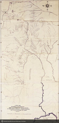
A New Map: The Shuara (Jivaro) territory based on the observations and explorations of Padre Alberto Castagnoli, misionero Salesiano, and Victor Wolfgang von Hagen, 1935, Eastern Peru (northern Amazonas district) and Western Ecuador, signed by Wolfgang von Hagen to Frank Chapman
ptc-7797
A New Map: The Shuara (Jivaro) territory based on the observations and explorations of Padre Alberto Castagnoli, misionero Salesiano, and Victor Wolfgang von Hagen, 1935, Eastern Peru (northern Amazonas district) and Western Ecuador, signed by Wolfgang von Hagen to Frank Chapman
1999
Transparencies -- Color
4 x 5
Object / Specimen Location: American Museum of Natural History, Ornithology Library
South America
Photographic Transparency Collection
AMNH Special Collections: Photographic Transparency Collection, Transparency number:
American Museum of Natural History Research Library
Information on rights available at the repository.
American Museum of Natural History
Collection
Citation
Beckett, J. (photographer), “A New Map: The Shuara (Jivaro) territory based on the observations and explorations of Padre Alberto Castagnoli, misionero Salesiano, and Victor Wolfgang von Hagen, 1935, Eastern Peru (northern Amazonas district) and Western Ecuador, signed by Wolfgang von Hagen to Frank Chapman,” AMNH Research Library | Digital Special Collections, accessed July 27, 2024, https://lbry-web-007.amnh.org/digital/index.php/items/show/41497.

