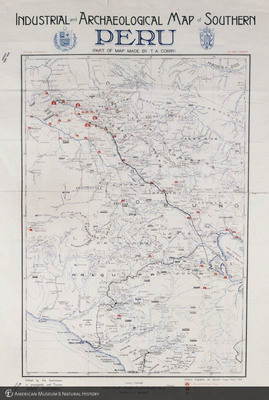
Industrial and Archeological Map of Southern Peru (Part of map made by T. A. Corry), edited by the Commission on Propaganda and Tourism, Cusco Centenniale
ptc-7798
Industrial and Archeological Map of Southern Peru (Part of map made by T. A. Corry), edited by the Commission on Propaganda and Tourism, Cusco Centenniale
1999
Transparencies -- Color
4 x 5
Object / Specimen Location: American Museum of Natural History, Ornithology Library
Peru
Photographic Transparency Collection
AMNH Special Collections: Photographic Transparency Collection, Transparency number:
American Museum of Natural History Research Library
Information on rights available at the repository.
American Museum of Natural History
Collection
Citation
Beckett, J. (photographer), “Industrial and Archeological Map of Southern Peru (Part of map made by T. A. Corry), edited by the Commission on Propaganda and Tourism, Cusco Centenniale,” AMNH Research Library | Digital Special Collections, accessed July 26, 2024, https://lbry-web-007.amnh.org/digital/index.php/items/show/41528.

