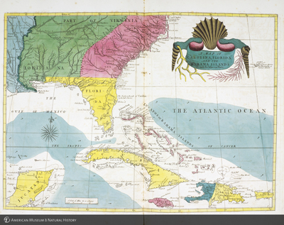
Map depicting British, French and Spanish colonies from Catesby's Natural history of Carolina, Florida and the Bahama Islands
b10487451_2
Map depicting British, French and Spanish colonies from Catesby's Natural history of Carolina, Florida and the Bahama Islands
1747
Hand-colored engravings
The natural history of Carolina, Florida, and the Bahama island : containing the figures of birds, beasts, fishes, serpents, insects, and plants : particularly, the forest-trees, shrubs, and other plants, not hitherto described, or very incorrectly figured by authors : together with their descriptions in English and French : to which, are added observations on the air, soil, and waters : with remarks upon agriculture, grain, pulse, roots, &c. : to the whole, is prefixed a new and correct map of the countries treated of
RF-13-J
RF-13-K
AMNH Librar catalog record: http://libcat1.amnh.org/record=b1048745
American Museum of Natural History Research Library
Information on rights available at the repository
Bibliographic Number: <a href="http://libcat1.amnh.org/record=b1048745%20target=_blank">b10487451</a>
American Museum of Natural History

